Navigate by Stars
Supplies, instructions, resources, and worksheets are below!

North Star
Project Description
Today, navigation is done using the GPS (Global Positioning System) that uses information from satellites to tell you where you are and how to get to a particular location. Before GPS, people traveled long distances navigating by the stars, sun, moon, planets, ocean and tradewinds. This form of navigation is called Wayfinding. In this activity, you’ll learn how to navigate by stars. The stars act as lampposts to help people find their way. If you can identify the stars as they rise and set, and if you have memorized where they rise and set, you can find your direction.
Activity Time
1-2 days
Supplies Needed
About 5+ pieces of printer paper
In-The-Sky.org website
Google Maps or you can use a printed world map or globe if you have one.
88 Modern Constellations
Investigative Worksheet
Learning Objectives
Awareness of your current location and surroundings
Identify stars and constellations
Identify North and South
Understand how to use the stars to navigate your direction
Understand latitude and longitude
Understand Northern and Southern Hemispheres
Understand how people traveled before modern technologies
Using Google maps
Vocabulary Terms to Understand
Look up each word and write their definition on paper.
constellation
navigate
Wayfinding
Northern hemisphere
Southern hemisphere
equator
latitude
longitude
North Star
Little Dipper
Southern Cross
Magnetic North
True North
circumpolar
Informational Videos
Instructions
1. Use Google Maps, a world map, or globe to pick various cities. Pick 1 or 2 from the Northern hemisphere, and 1 or 2 from the Southern hemisphere. Pick your current city.
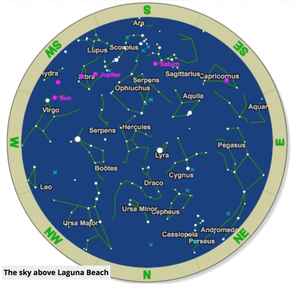
2. Go to In-The-Sky.org. Set the city location by changing/entering the latitude and longitude for each of your city locations, and print out each star chart. Below is what one looks like for Laguna Beach, CA.

Star Map for Laguna Beach, CA
3. If the name of your location is not printed on the star chart, write the city/location on each star chart that you print.
4. Print the Investigative Worksheet to record your findings and take notes. Draw a table like the one shown below to record data about each star chart.

5. What constellations can you find in each chart? Circle and label them.
6. Is the North Star useful to navigate in all parts of the world?
Questions
Which stars are useful for navigation in the Northern hemisphere?
Which stars are useful for navigation in the Southern hemisphere
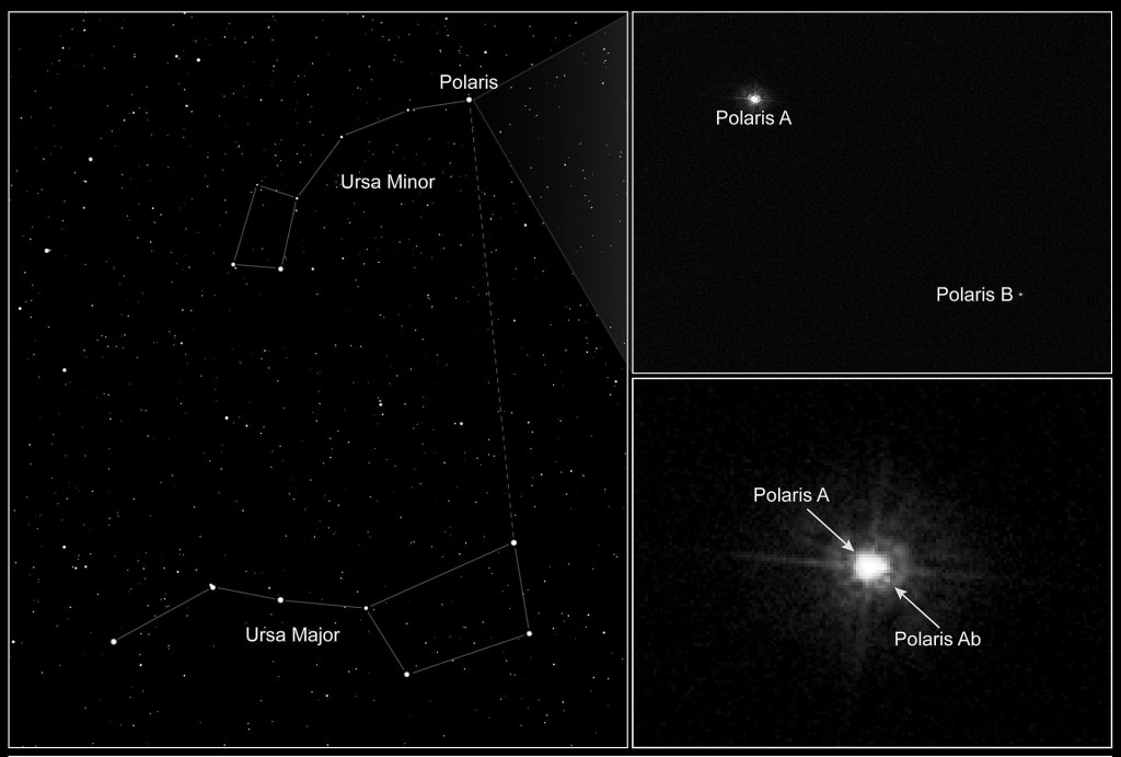
How do you find the North Star?
What are other ways of wayfinding?
More Resources
wikiHow: How to Navigate by the Stars
Find Your Way Using Stars
The Beginners Guide to Navigating the Stars
Space.com: Navigating Stars
Find North, Find South, Tell Time
PBS: Polynesia’s Genius Navigators
Polynesian Navigation
Star Compass: Learning from the Polynesians
Navigation
History of Navigation
Celestial Navigation
List of Selected Stars for Navigation
